Update: There was a race to completing a closed core tropical cyclone between Tropical Depressions 9 and 10 in the Atlantic. Across the far eastern Atlantic, Tropical Depression 10 organized first at 8PM CVT and was dubbed Tropical Storm Hermine. At 11PM EDT, TD9 was named Tropical Storm Ian.
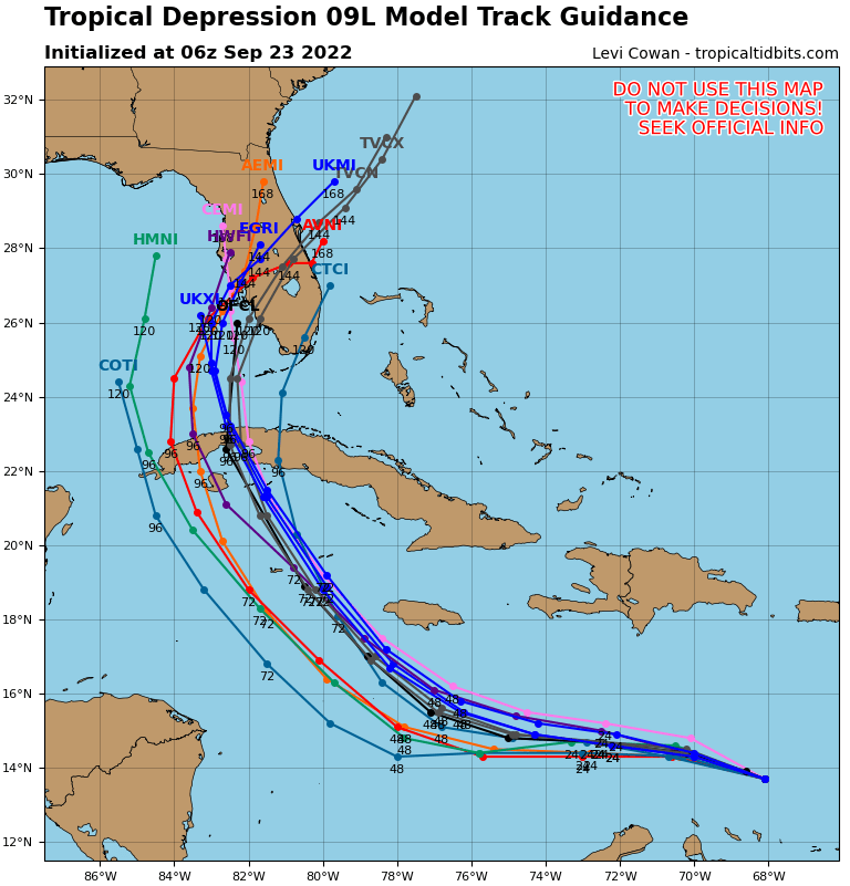
Here we go… As of 5AM AST, the National Hurricane Center confirmed Invest98L has developed into Tropical Depression 9 (or #TD9 for short) with well-defined circulation, 35mph maximum sustained winds, and 1006mb minimum pressure about 615mi ESE of Kingston, Jamaica moving WNW@13mph into more favorable conditions in next 24-48hrs. Track uncertainty is high yet current Hurricane models are projecting a Florida landfall and this could definitely change with time. The entire eastern Gulf Coast should be #WeatherAware and review their Hurricane Plans in preparation for next week.

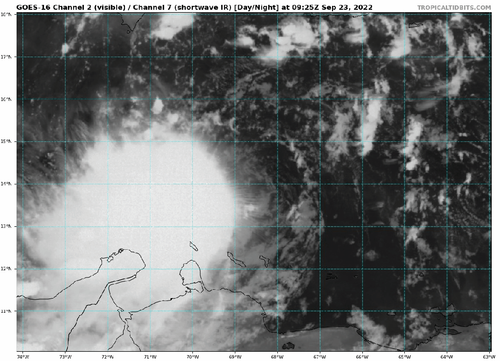
Tropical Depression 9 is not just skipping over the Caribbean Sea and is expected to produce heavy rainfall over the weekend. TD9 may eventually be named Tropical Storm Hermine later today with majority of convection centered SW of its circulation. You can see the circulation in the following satellite images is not aligned with the convection and the system will be restructuring before any substantial intensification can occur. Until then, flash flooding, water spouts, and possibility of mudslides are considered the main hazards for Aruba, Bonaire, and Curaçao. Tropical Storm advisories may commence as TD9 progresses toward Jamaica and the Cayman Islands where similar hazards and higher winds are expected.

Model tracks may fluctuate as TD9 progresses, but we cannot focus on just the center line and fear-monger. Effects of Tropical Storms and Hurricanes can be felt on communities 100s of miles from their center of circulation. Stay Weather Aware and use trusted sources such as the National Hurricane Center, local meteorologists, and your local government. There has never been more weather data freely available on the Internet and legitimate weather sources like https://www.tropicaltidbits.com and https://www.spaghettimodels.com are more excellent options to stay updated.

With Tropical Storm force winds approaching United States mainland Monday at the earliest, eastern Gulf Coast and Florida residents should start making plans according to their Hurricane Plan and assess as the storm track changes. If you don’t have a Hurricane Plan or Disaster Supply Kit, a checklist and suggestions are available on the Florida DEM Hurricane Hazard website. Travelers from out of state or country may want to check their travel arrangements for cancellation and Hurricane policies. If traveling to the Walt Disney World Resort, their policy is available online. Remember Walt Disney World resorts are inland and rated for major hurricanes and considered a safe option for evacuation by local residents.
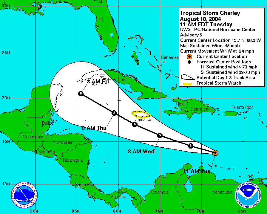
We can be grateful for the technological advances in hurricane forecasting. Compare the current cone for TD9 with the 3 day forecast cone of Hurricane Charley in 2004 when near the same location. While Charley formed further East and soon to be Hermine (actually now, Ivan) will hopefully not reach its ferocity, Florida residents had far less time to prepare in 2004 than we do now.
